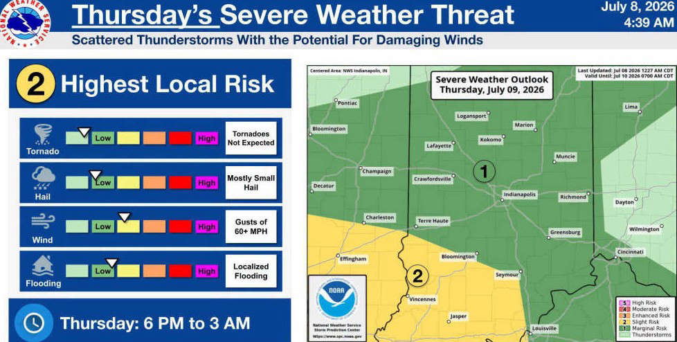
INDIANAPOLIS - The National Weather Service in Indianapolis is forecasting the potential for strong to severe thunderstorms across south-central Indiana on Thursday evening, July 9, into early Friday morning, July 10.
Bartholomew, Johnson, Jackson, Jennings, Decatur, Brown, and Shelby Counties are currently under a Marginal Risk (Level 1 of 5) for severe weather late Thursday into early Friday (6 p.m. to 3 a.m.).
Scattered thunderstorms are expected to develop during the evening and overnight hours. While widespread severe weather is not anticipated, the NWS says a few storms could become severe.
Thursday hazards include:
- Damaging wind gusts over 60 mph (primary threat)
- Small hail
- Localized flooding from heavy rainfall
- Tornadoes are not expected at this time
 Columbus approves affordable housing agreement with Gene B. Glick Company
 City orders condemnation, demolition for neglected Sycamore Street residence
 Columbus expands downtown social district boundaries to include Inn at Irwin Gardens
 Ivy Tech Columbus hosts 'spooky' canned food drive for student food pantry
 North Vernon man arrested after alleged breaking and entering